
One of a map’s key features is that each of its elements means something, and these are usually clarified in a legend. What does a map based solely on this feature look like? Could it even be classified as a map at all? In this section I venture into uncharted territories to explore the possibilities of cartographic displays and their tools. I focus primarily on non-material things like conceptions, dreams, ideas, perceptions and so on.

Jordan River Basin
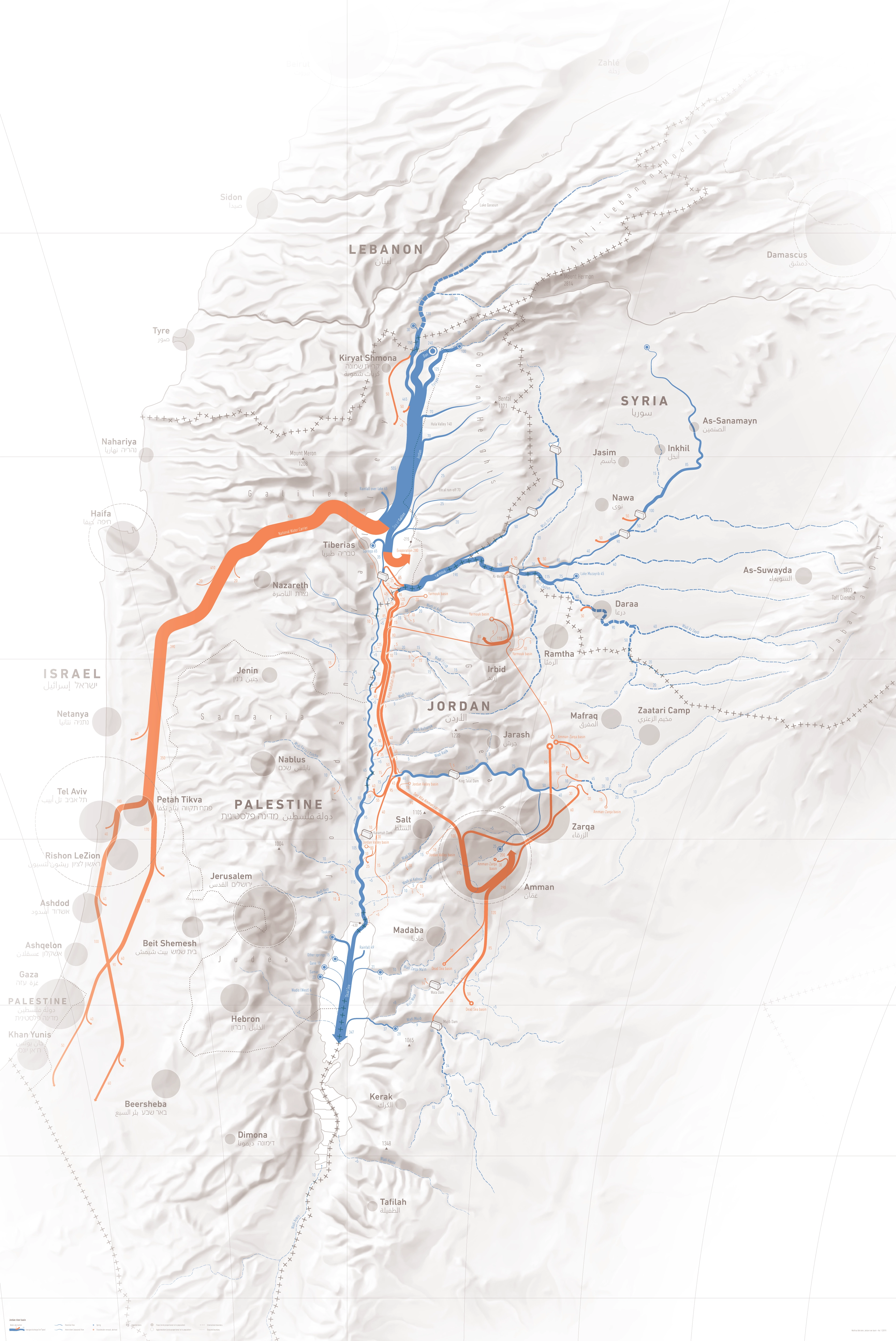
DescriptionCartographic Sankey diagram of the Jordan river.
- Geographic coverage Lebanon, Israel, Jordan, Syria, Palestine, Jordan (river)
- Type of visual artwork Cartographic illustration
- Year of publication 2019
- Media type Image/webp
- Size 3341 × 5000 px
- Language English
- Creator Matthias Beilstein
- Credit Cartographic illustration by Matthias Beilstein
- Copyright notice 2019. Matthias Beilstein. All rights reserved.
- Download Palestine_jordan_river_basin.webp
- URL https://beilstein.art/media/images/palestine_jordan_river_basin.webp
-
NFT
 Blockchain: Solana
Marketplace: Exchange.art
https://exchange.art/single/BYoWTh4dhzCoZe1zYKSJZFRVJQzjPkeE9tobCmvd6X8Z