
One of a map’s key features is that each of its elements means something, and these are usually clarified in a legend. What does a map based solely on this feature look like? Could it even be classified as a map at all? In this section I venture into uncharted territories to explore the possibilities of cartographic displays and their tools. I focus primarily on non-material things like conceptions, dreams, ideas, perceptions and so on.

Rivers of the Aral Sea Basin
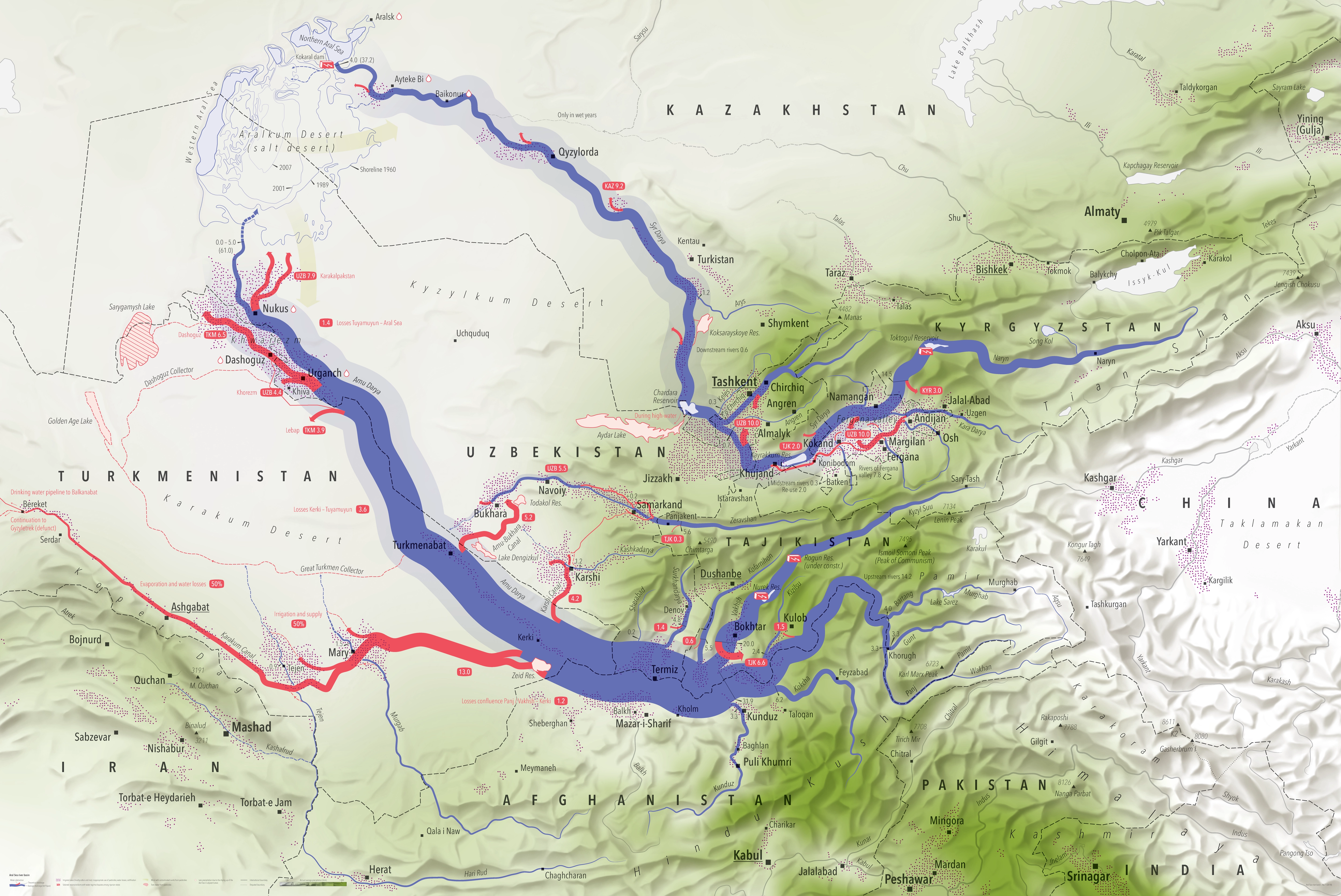
DescriptionThe river systems of the Aral Sea basin as a Sankey diagram (the line width represents the average annual runoff) in Central Asia. Canals and collectors are red, natural rivers are blue. The relief for the topography and the average annual rainfall (the greener, the more precipitation) complete the theme.
- Geographic coverage Aral Sea, Central Asia
- Type of visual artwork Cartographic illustration
- Year of publication 2018
- Media type Image/webp
- Size 5000 × 3341 px
- Language English
- Creator Matthias Beilstein
- Credit Cartographic illustration by Matthias Beilstein
- Copyright notice 2018. Matthias Beilstein. All rights reserved.
- Download Central_asia_aral_sea_river_basin.webp
- URL https://beilstein.art/media/images/central_asia_aral_sea_river_basin.webp
-
NFT
 Blockchain: Solana
Marketplace: Exchange.art
https://exchange.art/single/GubVNjHs7e3Bh22oupqf2SdWCmxJQBTV9konrotSh7SU