Zurück zur Übersicht (Kartenbibliothek)

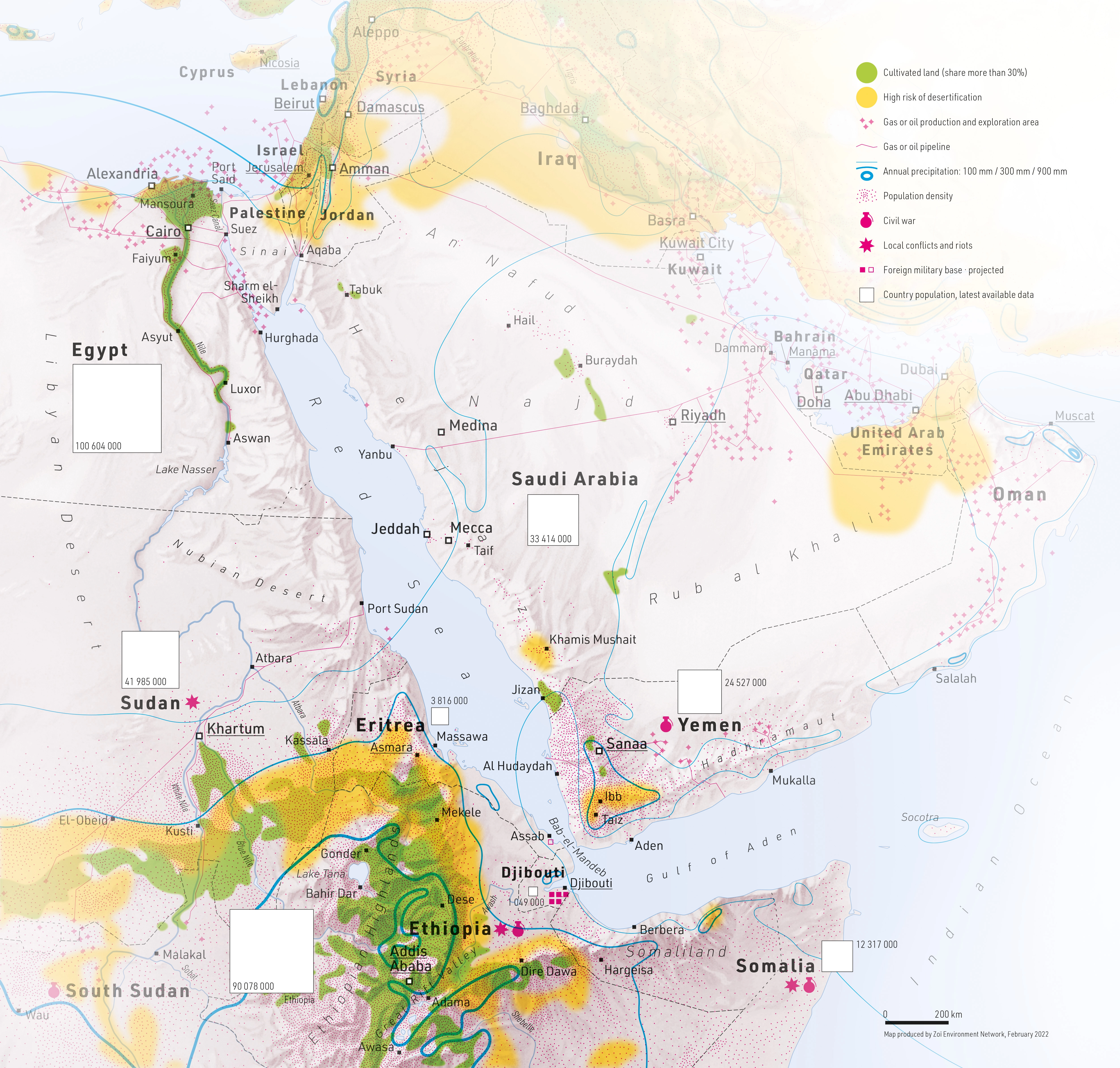
Red Sea, Middle East East and Horn of Africa Land Cover, Desertification and Population
BeschreibungExperimentelle Karte mit Fokus Umwelt. Abgebildet ist ein Mix zwichen natur- und kulturräumlichen Themen. Zum Thema Naturraum gehören die Kartenelemente Desertifikationsrisiko und Niederschlag; zum Thema Kulturraum die Kartenelemente Bevölkerung, politische Stabilität, Kulturland, Gas- und Ölproduktion sowie Pipelines.
- Geografische Abdeckung Rotes Meer, Mittlerer Osten, Horn von Afrika
- Medium/Kunstform Karte
- Publikationsjahr 2022
- Medientyp Image/webp
- Grösse 5006 × 4772 px
- Sprache Englisch
- Ersteller Matthias Beilstein
- Mitwirkende Zoï Environment Network
- Hinweistext Karte: Matthias Beilstein / Zoï Environment Network
- Copyright-Vermerk 2022. Matthias Beilstein / Zoï Environment Network. Alle Rechte vorbehalten.
- Download Map_red_sea_middle_east_east_africa_land_cover_desertification_population.webp
- URL https://beilstein.art/media/images/map_red_sea_middle_east_east_africa_land_cover_desertification_population.webp
-
NFT
 Blockchain: Ethereum
Marktplatz: Foundation.app
https://foundation.app/mint/eth/0xdB63489D6Dda1a30aee1D89978F2B337059e6675/4