
A map library is a treasure trove of geographic information. It is not just an archive, it is a window to the world and the times—a place of discovery and curiosity. One can lose oneself within it, but also find oneself. Many maps of different regions and a wide range of topics are stored here and made accessible. These are maps with a particular relevance that have been developed and designed over time. May the maps presented provide both factual insight and visual inspiration!

Armenia Climate Change
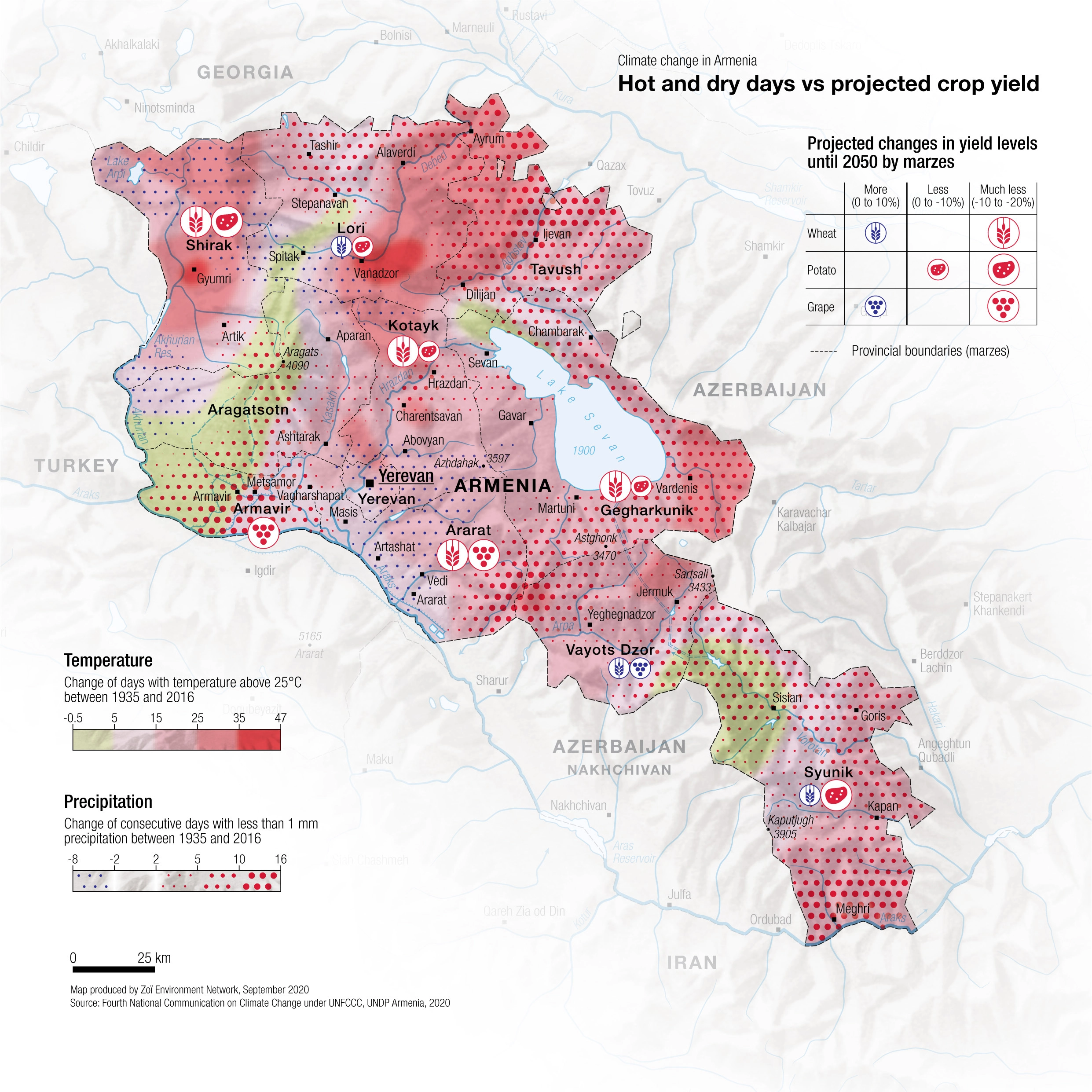
DescriptionHot and dry days vs projected crop yield
- Geographic coverage Armenia
- Type of visual artwork Map
- Year of publication 2020
- Media type Image/webp
- Size 2482 × 2482 px
- Language English
- Creator Matthias Beilstein
- Source(s) Fourth National Communication on Climate Change under UFCCC; UNDP Armenia
- Contributor Zoï Environment Network
- Credit Map by Matthias Beilstein / Zoï Environment Network
- Copyright notice 2020. Matthias Beilstein / Zoï Environment Network. All rights reserved.
- Download Map_armenia_climate_change.webp
- URL https://beilstein.art/media/images/map_armenia_climate_change.webp
-
NFT
 Blockchain: Ethereum
Marketplace: Foundation.app
https://foundation.app/mint/eth/0x9A04D3f95bCe0c2F682D1966af93eb2Fec3B9fe6/1