

Caucasus Water
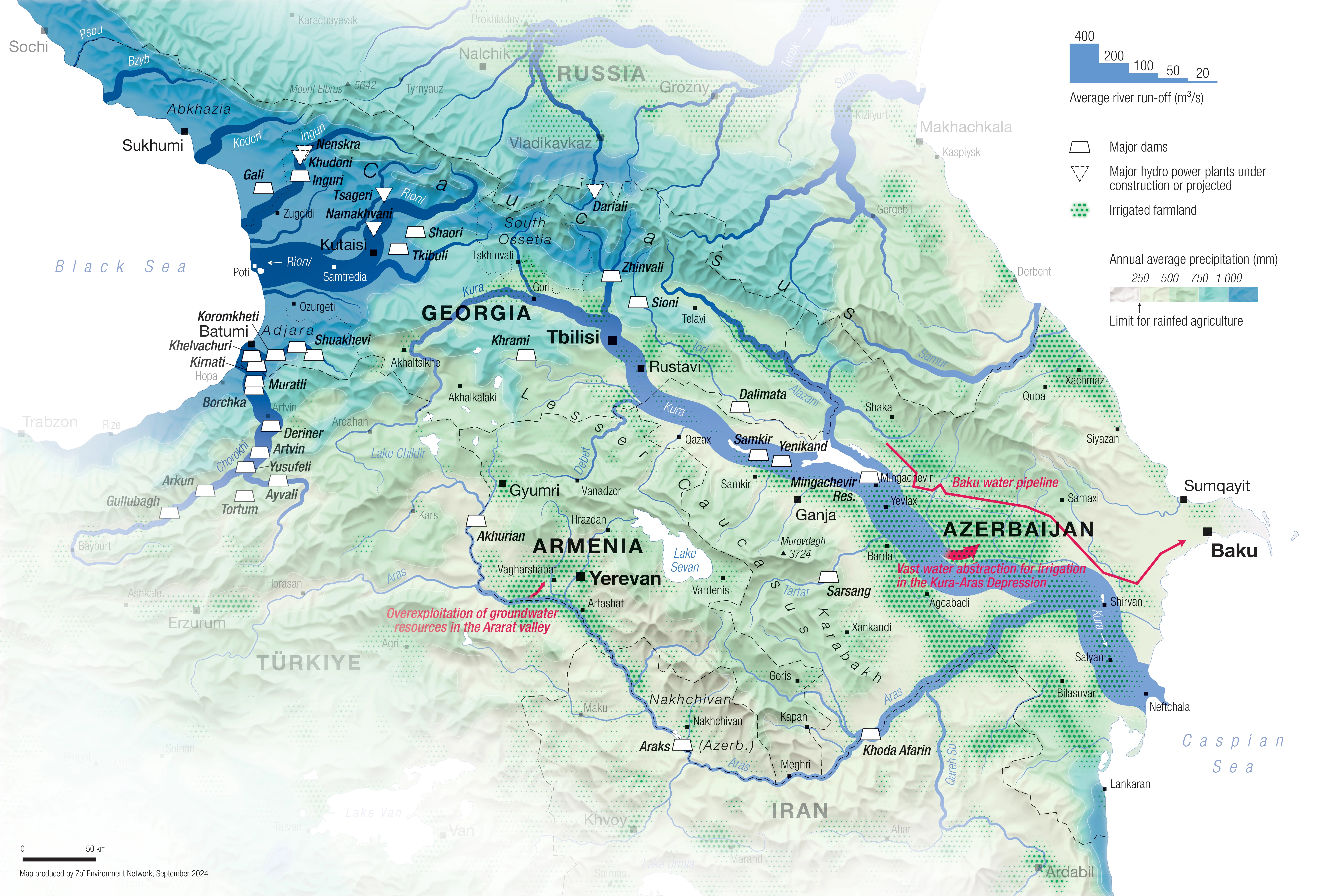
DescriptionMap of the Caucasus region with the main rivers, depicted as a cartographic Sankey diagram. The precipitation levels, irrigated farmland, and the largest dams complete the theme.
- Geographic coverage Caucasus
- Type of visual artwork Map
- Year of publication 2024
- Media type Image/webp
- Temporal coverage 2024
- Size 6354 × 4299 px
- Language English
- Creator Matthias Beilstein
- Contributor Zoï Environment Network
- Credit Map by Matthias Beilstein / Zoï Environment Network
- Copyright notice 2024. Matthias Beilstein / Zoï Environment Network. All rights reserved.
- Download Map_caucasus_river_run_off_precipitation_dams_2024.webp
- URL https://beilstein.art/media/images/map_caucasus_river_run_off_precipitation_dams_2024.webp
-
NFT
 Blockchain: Ethereum
Marketplace: Foundation.app
https://foundation.app/mint/eth/0x116E6597D4a73b04b4fB0A5629d458A49cF4a6F7/1