
A map library is a treasure trove of geographic information. It is not just an archive, it is a window to the world and the times—a place of discovery and curiosity. One can lose oneself within it, but also find oneself. Many maps of different regions and a wide range of topics are stored here and made accessible. These are maps with a particular relevance that have been developed and designed over time. May the maps presented provide both factual insight and visual inspiration!

Central Asia Mountains, Hydropower Plants (Russian)
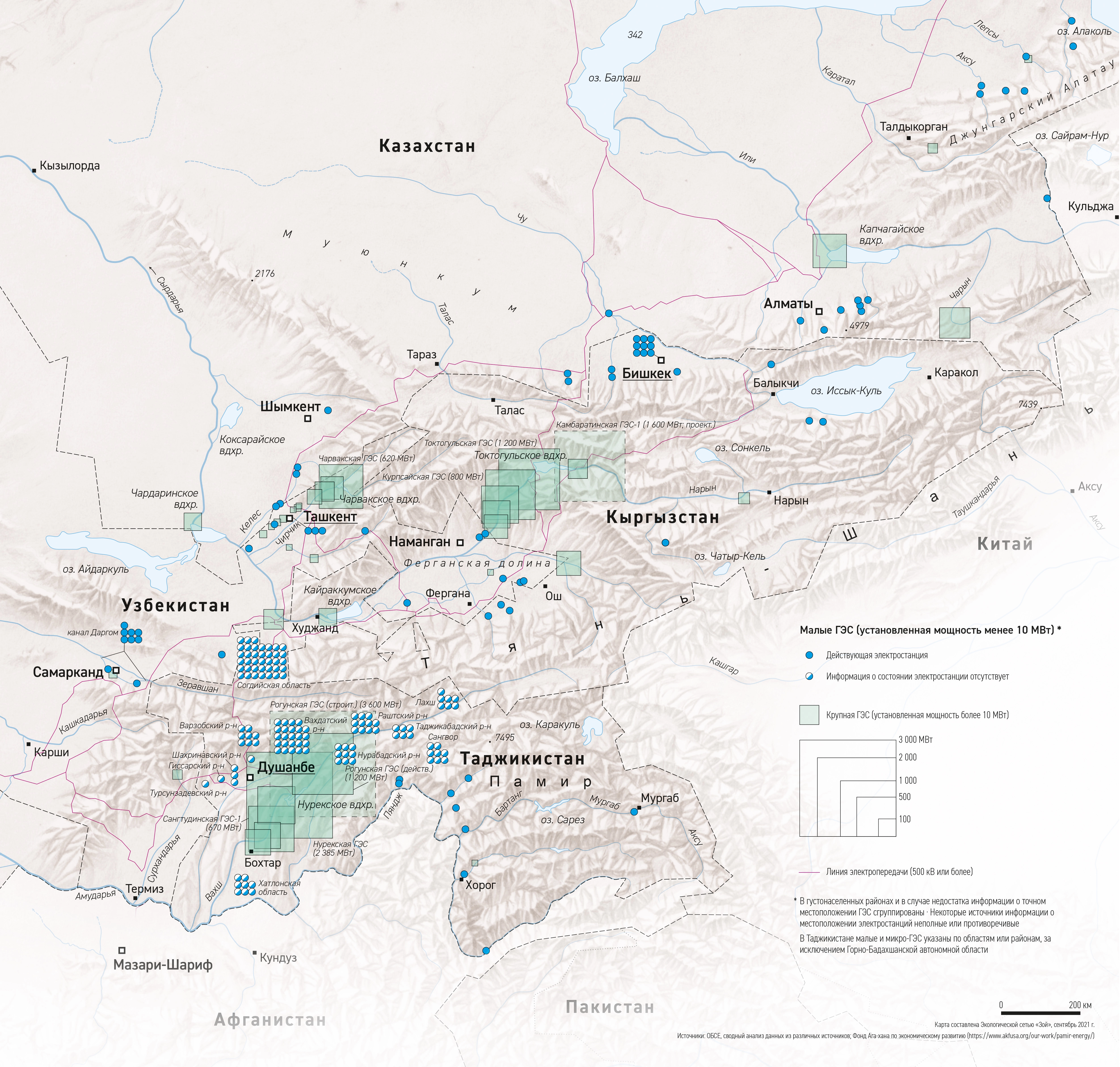
DescriptionOverview map of hydropower plants in the largest contiguous mountainous part of Central Asia (Tienshan and Pamir in the countries of Kyrgyzstan, Tajikistan, parts of Uzbekistan and Kazakhstan).
- Geographic coverage Central Asia
- Type of visual artwork Map
- Year of publication 2021
- Media type Image/webp
- Size 5012 × 4772 px
- Language Russian
- Creator Matthias Beilstein
- Source(s) OSCE; Aga Khan Foundation
- Contributor Zoï Environment Network
- Funder Organization for Security and Co-operation in Europe (OSCE)
-
Link
Report auf OSZE
https://www.osce.org/oceea/513787Report auf Zoï Environment Network
https://zoinet.org/product/advancing-energy-security-ca/ - Credit Map by Matthias Beilstein / Zoï Environment Network
- Copyright notice 2021. Matthias Beilstein / Zoï Environment Network. All rights reserved.
- Download Map_central_asia_mountains_hydropower_plants_russian.webp
- URL https://beilstein.art/media/images/map_central_asia_mountains_hydropower_plants_russian.webp
-
NFT
 Blockchain: Ethereum
Marketplace: Foundation.app
https://foundation.app/mint/eth/0x65B2b8CAf9E78AB6B61C46032f853284327Bd913/8