Back to overview (Map Library)

Kyrgyzstan Disaster Risk and Climate Change (Kyrgyz)
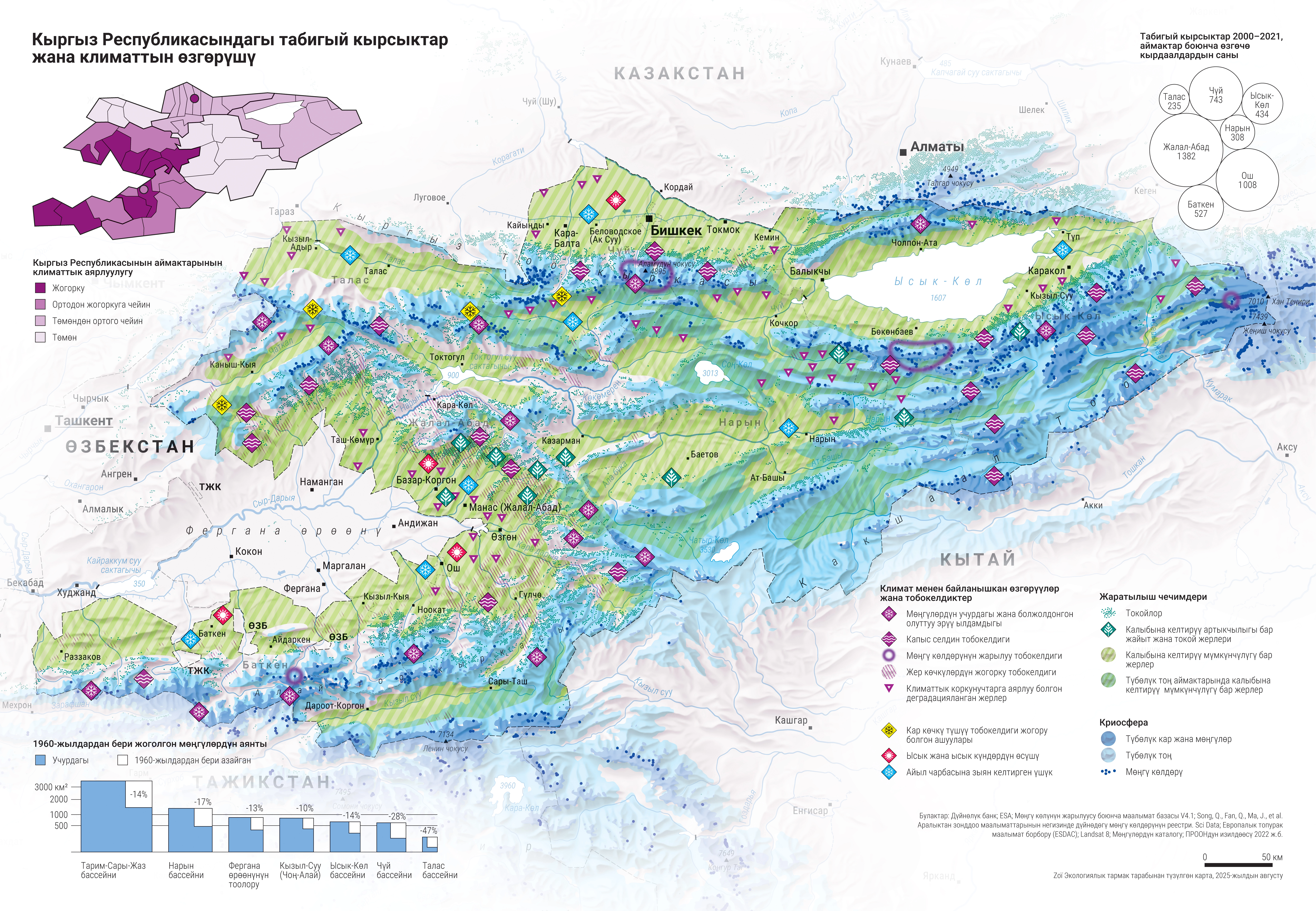
DescriptionMap of Kyrgyzstan about the connection between climate change and natural disasters. The map consists of the following components:
- Climate-related changes and risks
- Nature-based solutions
- Cryosphere
- Climate vulnerability by district
- Geographic coverage Kyrgyzstan
- Type of visual artwork Map
- Year of publication 2025
- Media type Image/webp
- Size 9450 × 6544 px
- Language Kyrgyz
- Creator Matthias Beilstein
- Source(s) World Bank; ESA; Glacier Lake Outburst Flood Database V4.1; Song, C., Fan, C., Ma, J. et al. A spatially constrained remote sensing-based inventory of glacial lakes worldwide. Sci Data; European Soil Data Centre (ESDAC); Landsat 8; Catalog of glaciers of the USSR; UNDP
- Contributor Zoï Environment Network
- Funder United Nations Institute for Training and Research (UNITAR)
-
Link
Brochure on Zoï Environment Network
https://zoinet.org/product/cc-kyrgyzstan-thematic-maps/ - Credit Map by Matthias Beilstein / Zoï Environment Network
- Copyright notice 2025. Matthias Beilstein / Zoï Environment Network. All rights reserved.
- Download Map_kyrgyzstan_disaster_risk_climate_change_2025_kyrgyz.webp
- URL https://beilstein.art/media/images/map_kyrgyzstan_disaster_risk_climate_change_2025_kyrgyz.webp
-
NFT
 Blockchain: Ethereum
Marketplace: Foundation.app
https://foundation.app/mint/eth/0x83918Be09c9a73b439FEaAbE4fF5D1Ce7BDE5424/3