
A map library is a treasure trove of geographic information. It is not just an archive, it is a window to the world and the times—a place of discovery and curiosity. One can lose oneself within it, but also find oneself. Many maps of different regions and a wide range of topics are stored here and made accessible. These are maps with a particular relevance that have been developed and designed over time. May the maps presented provide both factual insight and visual inspiration!

Middle East Groundwater Population
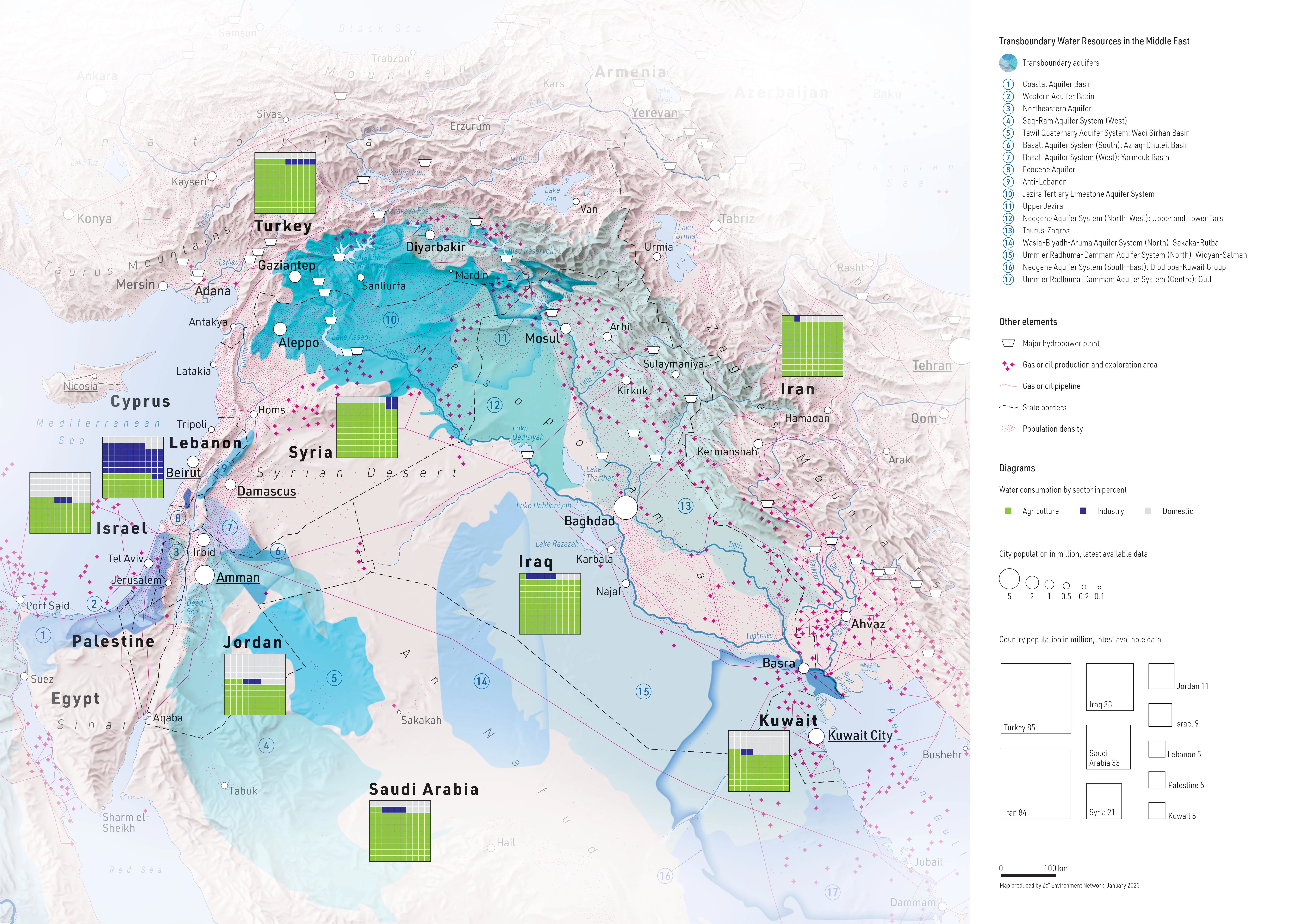
DescriptionWater consumption and location of transboundary aquifers in the Middle East. Other elements such as large hydropower plants, gas and oil production and various elements relating to population serve as context and round off the map. Variant of several similar maps.
- Geographic coverage Middle East
- Type of visual artwork Map
- Year of publication 2023
- Media type Image/webp
- Size 6709 × 4772 px
- Language English
- Creator Matthias Beilstein
- Source(s) IGRAC; WHYMAP and the Groundwater Resources of the World; World Bank, Mapstand
- Contributor Zoï Environment Network
- Credit Map by Matthias Beilstein / Zoï Environment Network
- Copyright notice 2023. Matthias Beilstein / Zoï Environment Network. All rights reserved.
- Download Map_middle_east_groundwater_population.webp
- URL https://beilstein.art/media/images/map_middle_east_groundwater_population.webp
-
NFT
 Blockchain: Ethereum
Marketplace: Foundation.app
https://foundation.app/mint/eth/0xdB63489D6Dda1a30aee1D89978F2B337059e6675/3