
A map library is a treasure trove of geographic information. It is not just an archive, it is a window to the world and the times—a place of discovery and curiosity. One can lose oneself within it, but also find oneself. Many maps of different regions and a wide range of topics are stored here and made accessible. These are maps with a particular relevance that have been developed and designed over time. May the maps presented provide both factual insight and visual inspiration!

Palestine Air Pollution
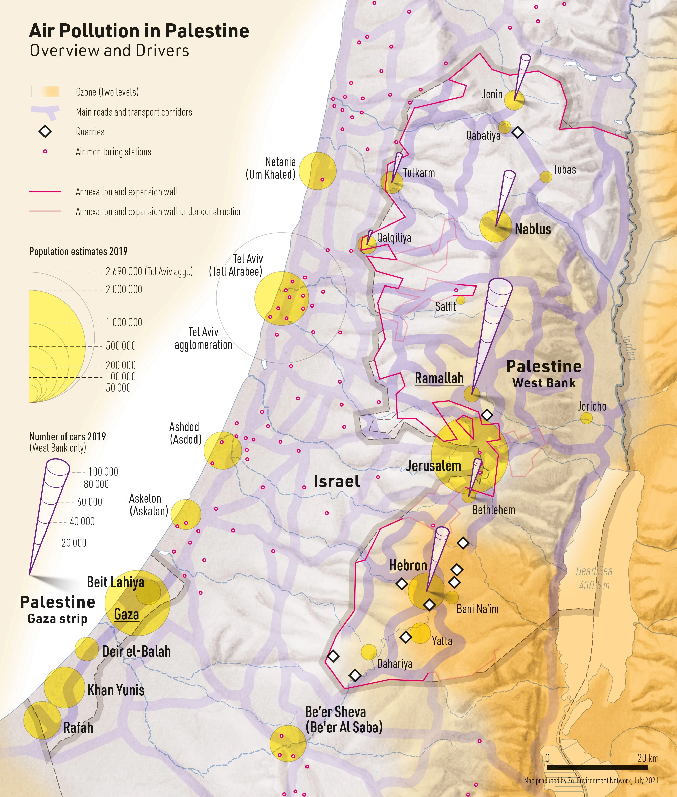
DescriptionMap of air pollution in Palestine. The map shows ozone pollution, air monitoring stations and, as drivers, main traffic routes, population centers (largest towns), number of cars and quarries.
- Geographic coverage Palestine, Israel
- Type of visual artwork Map
- Year of publication 2021
- Media type Image/webp
- Size 2677 × 3149 px
- Language English
- Creator Matthias Beilstein
- Contributor Zoï Environment Network
- Credit Map by Matthias Beilstein / Zoï Environment Network
- Copyright notice 2021. Matthias Beilstein / Zoï Environment Network. All rights reserved.
- Download Map_palestine_air_pollution.webp
- URL https://beilstein.art/media/images/map_palestine_air_pollution.webp
-
NFT
 Blockchain: Ethereum
Marketplace: Foundation.app
https://foundation.app/mint/eth/0xE0044c49109124DB5672b865c7eb626F14E52d86/1