
A map library is a treasure trove of geographic information. It is not just an archive, it is a window to the world and the times—a place of discovery and curiosity. One can lose oneself within it, but also find oneself. Many maps of different regions and a wide range of topics are stored here and made accessible. These are maps with a particular relevance that have been developed and designed over time. May the maps presented provide both factual insight and visual inspiration!

Red Sea, Middle East East and Horn of Africa Land Cover, Desertification and Population
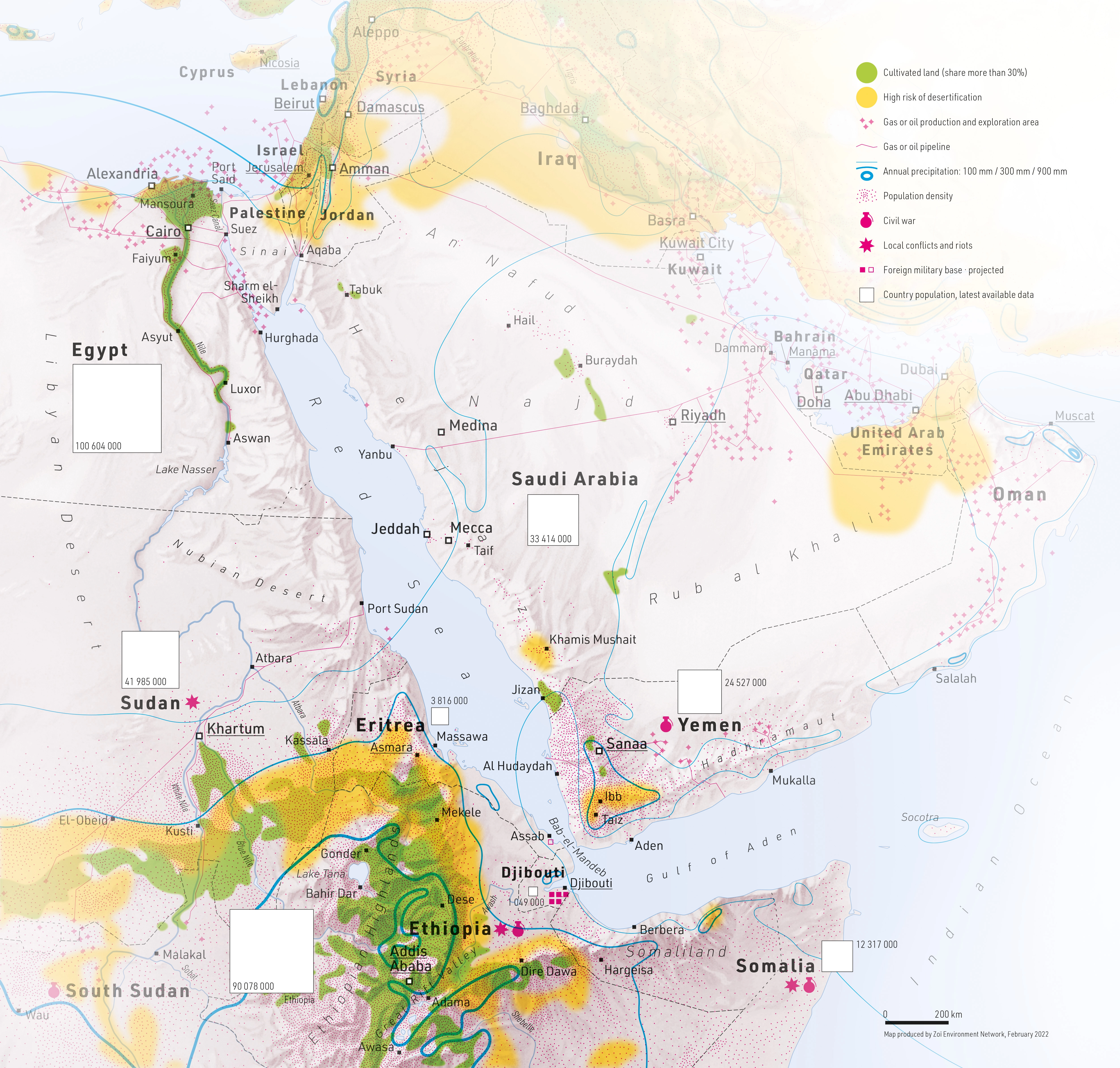
DescriptionExperimental map with an environmental focus. It presents a mix of natural and cultural spatial themes. The natural environment is represented by map elements such as desertification risk and precipitation, while the cultural environment includes population, political stability, cultivated land, gas and oil production, and pipelines.
- Geographic coverage Red Sea, Middle East, Horn of Africa
- Type of visual artwork Map
- Year of publication 2022
- Media type Image/webp
- Size 5006 × 4772 px
- Language English
- Creator Matthias Beilstein
- Contributor Zoï Environment Network
- Credit Map by Matthias Beilstein / Zoï Environment Network
- Copyright notice 2022. Matthias Beilstein / Zoï Environment Network. All rights reserved.
- Download Map_red_sea_middle_east_east_africa_land_cover_desertification_population.webp
- URL https://beilstein.art/media/images/map_red_sea_middle_east_east_africa_land_cover_desertification_population.webp
-
NFT
 Blockchain: Ethereum
Marketplace: Foundation.app
https://foundation.app/mint/eth/0xdB63489D6Dda1a30aee1D89978F2B337059e6675/4