Back to overview (Map Library)

Ukraine Air Quality
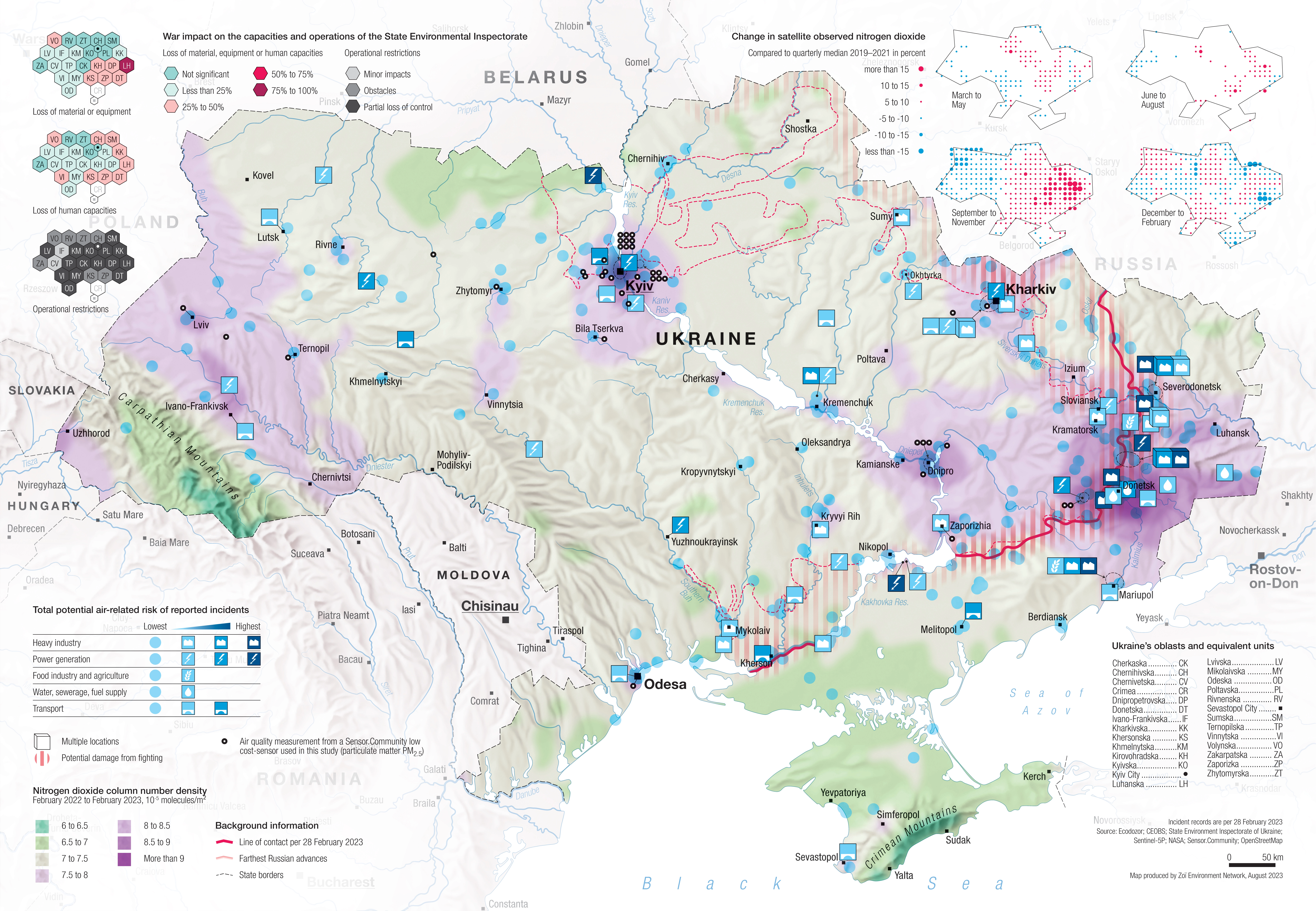
DescriptionMap of Ukraine showing air quality in the wake of the Russo-Ukrainian War (February 2022–February 2023). Twelve-month assessment. The following aspects are shown:
- Air quality (nitrogen dioxide)
- Measuring stations
- Operational impacts on state institutions dealing with air quality issues
- Geographic coverage Ukraine, southwestern Russia
- Type of visual artwork Map
- Year of publication 2025
- Media type Image/webp
- Temporal coverage 24 February 2022–28 February 2023
- Size 9450 × 6544 px
- Language English
- Creator Matthias Beilstein
- Source(s) Ecodozor; CEOBS; State Environment Inspectorate of Ukraine; Sentinel-5P; NASA; Sensor.Community; OpenStreetMap
- Contributor Zoï Environment Network
-
Link
Assessment report and maps
https://zoinet.org/product/osce-ukraine-one-year/ - Credit Map by Matthias Beilstein / Zoï Environment Network
- Copyright notice 2025. Matthias Beilstein / Zoï Environment Network. All rights reserved.
- Download Map_ukraine_conflict_damage_environment_air_quality_2023.webp
- URL https://beilstein.art/media/images/map_ukraine_conflict_damage_environment_air_quality_2023.webp
-
NFT
 Blockchain: Ethereum
Marketplace: Foundation.app
https://foundation.app/mint/eth/0xDaE4F37E3EC739654769B401B8ea2ce31951fe9b/17