
A map library is a treasure trove of geographic information. It is not just an archive, it is a window to the world and the times—a place of discovery and curiosity. One can lose oneself within it, but also find oneself. Many maps of different regions and a wide range of topics are stored here and made accessible. These are maps with a particular relevance that have been developed and designed over time. May the maps presented provide both factual insight and visual inspiration!

Western Balkans Air Quality and Health
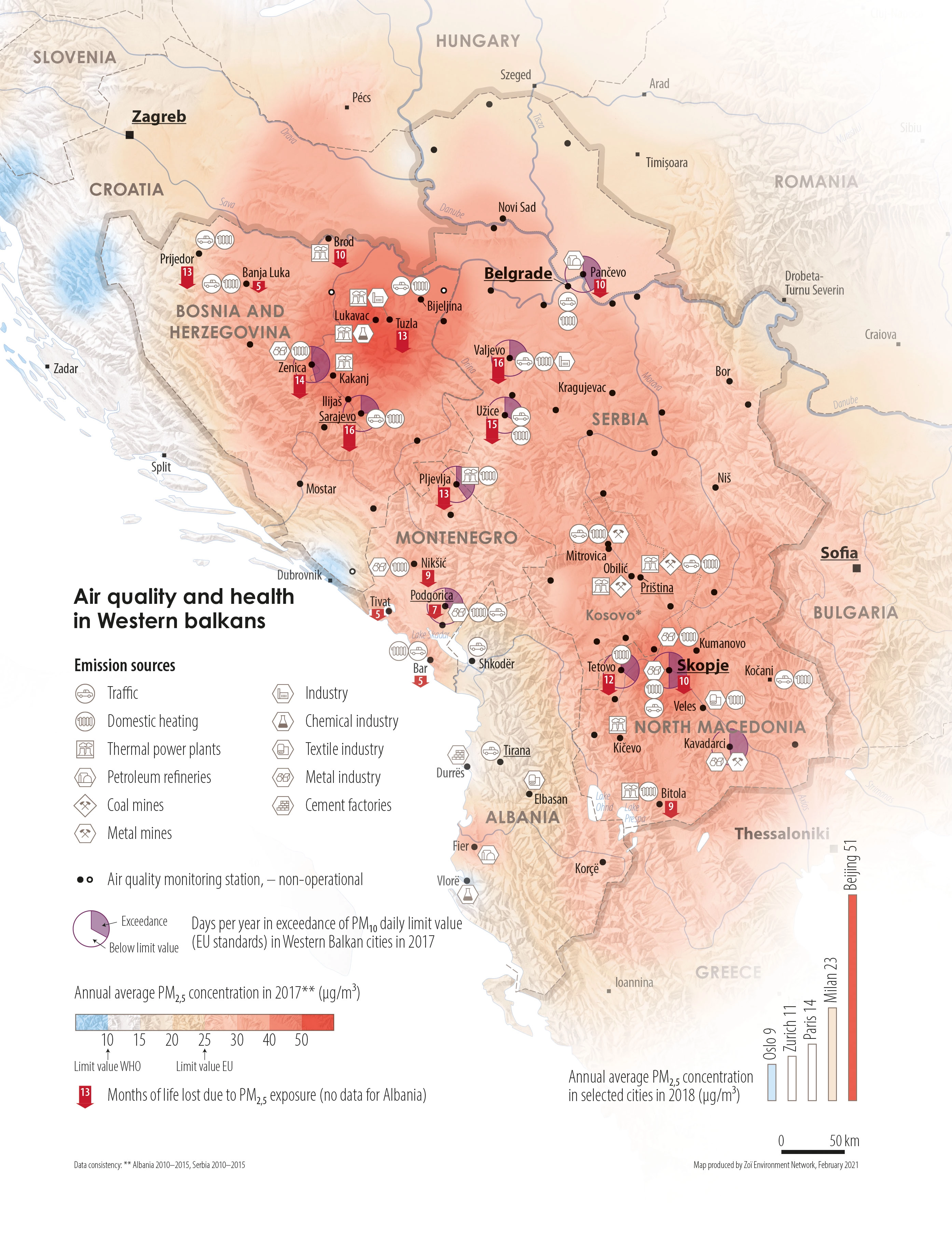
DescriptionOverview map of the Western Balkan countries Albania, Bosnia and Herzegovina, Montenegro, North Macedonia and Serbia on air quality. Most of the information relates to the largest settlements in the region. This includes emission sources broken down by industry or activity, information on exceeding PM10 limits or lost lifetime due to PM2.5 exposure. In addition, the air monitoring stations are shown as well as a simplified plot of the PM2.5 concentration in the region. The bar chart shows the PM2.5 exposure of some selected cities for comparison.
- Geographic coverage Western Balkans (Albania, Bosnia und Herzegovina, Kosovo, Montenegro, North Macedonia, Serbia)
- Year of publication 2021
- Media type Image/webp
- Size 2787 × 3614 px
- Language English
- Creator Matthias Beilstein
- Source(s) EEA; WHO; HEAL
- Contributor Zoï Environment Network
- Credit Matthias Beilstein / Zoï Environment Network
- Copyright notice 2021. Matthias Beilstein / Zoï Environment Network. All rights reserved.
- Download Map_western_balkans_air_quality_and_health.webp
- URL https://beilstein.art/media/images/map_western_balkans_air_quality_and_health.webp
-
NFT
 Blockchain: Ethereum
Marketplace: Foundation.app
https://foundation.app/mint/eth/0x5246AB97D04B4e184Dd1F6D78eeBAF9f4B3C5170/2