
A map library is a treasure trove of geographic information. It is not just an archive, it is a window to the world and the times—a place of discovery and curiosity. One can lose oneself within it, but also find oneself. Many maps of different regions and a wide range of topics are stored here and made accessible. These are maps with a particular relevance that have been developed and designed over time. May the maps presented provide both factual insight and visual inspiration!

World Mountains Electoral Districts
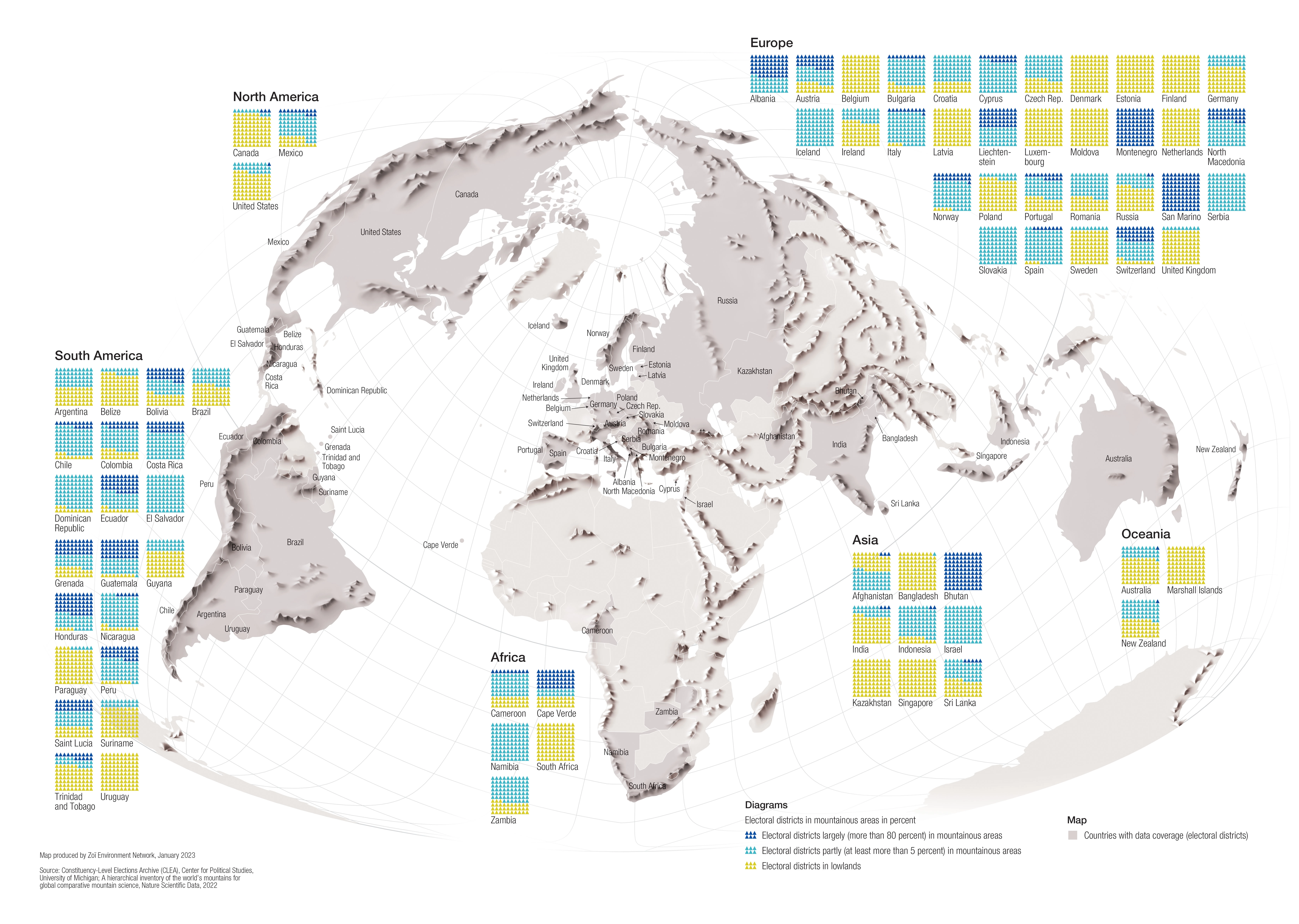
DescriptionWorld map of electoral districts in mountainous areas. The breakdown of electoral districts (in percent) located in mountainous areas is shown in diagrams.
- Geographic coverage World
- Type of visual artwork Map
- Year of publication 2023
- Media type Image/webp
- Temporal coverage 2022
- Size 6709 × 4772 px
- Language English
- Creator Matthias Beilstein
- Source(s) GMBA Mountain Inventory v2; Constituency-Level Elections Archive (CLEA)
- Contributor Zoï Environment Network
- Credit Map by Matthias Beilstein / Zoï Environment Network
- Copyright notice 2023. Matthias Beilstein / Zoï Environment Network. All rights reserved.
- Download Map_world_mountains_electoral_districts_percent_2023.webp
- URL https://beilstein.art/media/images/map_world_mountains_electoral_districts_percent_2023.webp
-
NFT
 Blockchain: Ethereum
Marketplace: Foundation.app
https://foundation.app/mint/eth/0xA08d2b2e145457085eD84f8D66427F7d482651bE/6